
A consolidated land position in Mineral County, Nevada
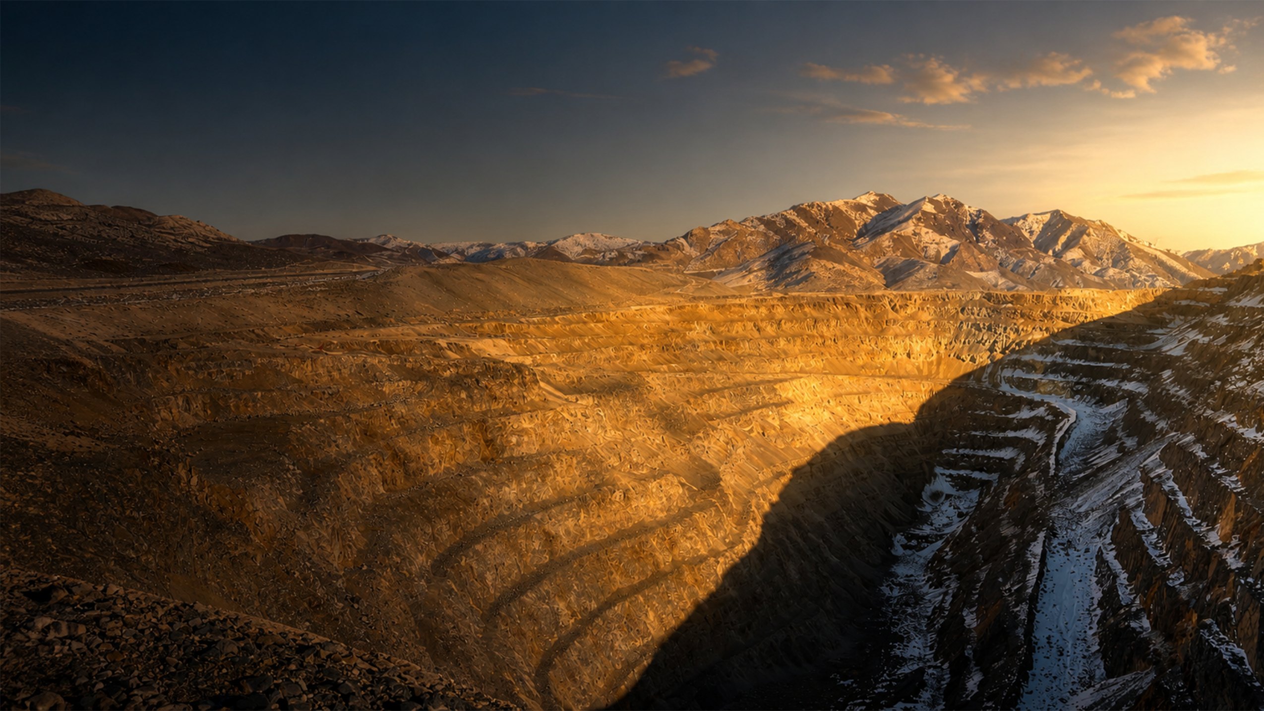
Flagship project · Nevada, USA
Santa FeGold Mine
A past-producing mine advancing toward a new generation of production
Explore the projectResource2.385 Moz AuEq
StageUpdated PEA under way
TargetConstruction in 2027
Project overview
A mine with a head start
Santa Fe is a past-producing open pit, heap leach gold and silver mine in Nevada's Walker Lane—an established mining jurisdiction with existing infrastructure and a clear development pathway.
The mine produced 359,202 ounces of gold and 702,067 ounces of silver between 1988 and 1995. Lahontan is now advancing a phased restart, led by shallow oxide material and supported by a larger sulfide resource.
Plus 45 additional claims held under option
136,515 metres of historical and modern drilling
Santa Fe, Slab, Calvada and York were previously mined by open pit
Updated pit-constrained MRE
2.385 Moz AuEq
+22% | +435 koz AuEq
The August 2026 estimate was prepared by RESPEC, effective 13 August 2026, using US$3,200/oz gold and US$40.00/oz silver.
0.78 g/t AuEq
0.61 g/t AuEq
Mineralisation extends beyond the conceptual pit shells in multiple areas
View Mineral Resource Estimate detail
| Deposit | Category | Tonnes (Mt) | Au (g/t) | Ag (g/t) | AuEq (g/t) | AuEq (koz) |
|---|---|---|---|---|---|---|
| Santa Fe Deposit | ||||||
| Oxide | Indicated | 15.90 | 0.47 | 4.15 | 0.59 | 301 |
| Oxide | Inferred | 13.18 | 0.32 | 2.74 | 0.41 | 172 |
| Sulfide | Indicated | 15.25 | 1.13 | 1.66 | 1.41 | 692 |
| Sulfide | Inferred | 28.42 | 0.68 | 0.56 | 0.86 | 782 |
| Slab · Calvada · York | ||||||
| Oxide | Indicated | 12.09 | 0.26 | 1.19 | 0.33 | 128 |
| Oxide | Inferred | 8.34 | 0.28 | 1.48 | 0.36 | 96 |
| Project total — Indicated | 47.53 | 0.72 | 5.55 | 0.78 | 1,195 | |
| Project total — Inferred | 60.61 | 0.59 | 2.40 | 0.61 | 1,190 | |
AuEq is inclusive of recovery. Cut-off grades are 0.10 g/t AuEq for oxide and transitional material and 0.30 g/t AuEq for sulfide material. Project totals include material not itemised above. Mineral resources that are not mineral reserves do not have demonstrated economic viability. Rounding may produce apparent discrepancies.
The restart case
Not a discovery,
A restart
Much of the work that defines an early-stage discovery has already happened at Santa Fe. The resource, historic workings, metallurgical history and access provide a practical foundation for the next development phase.
Known ground
More than 136 kilometres of drilling feeds the current block model, with just over half of contained ounces in the Indicated category
Existing footprint
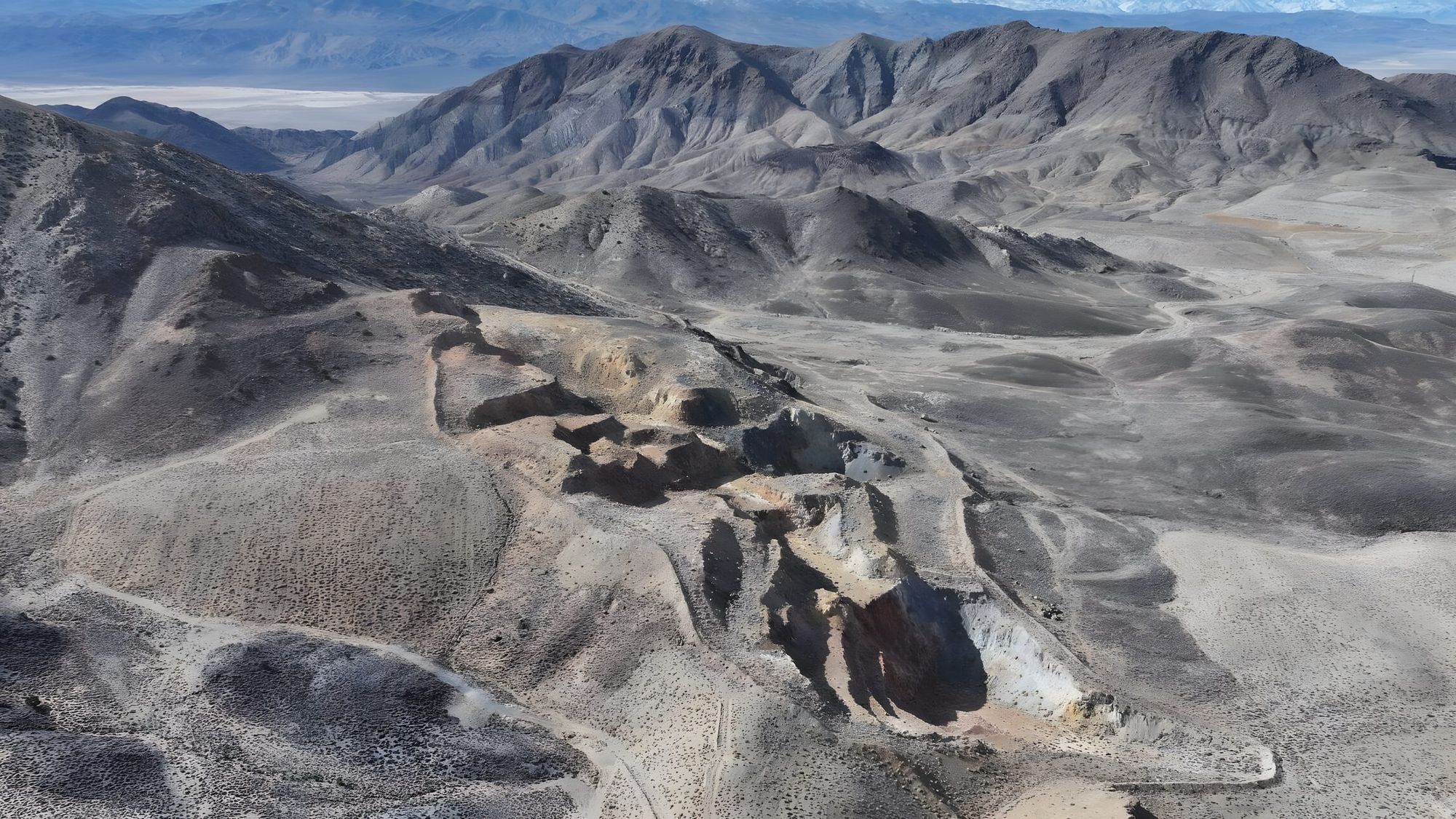
Three historic open pits and four heap leach pads remain on site, alongside established access and mine infrastructure
Permitting active
Nevada state mine permitting is under way for the Phase One oxide plan, with a federal Mine Plan of Operations to follow.
Development strategy
A phased route
back to production
Oxide
Shallow oxide material processed by conventional cyanide heap leach—the same approach used historically at Santa Fe. This plan is the basis of current state-level permitting.
- Cut-off grade
- 0.10 g/t AuEq
- Gold recovery
- 60%–79%
Sulfide
Higher-grade sulfide material below the oxide cap, being assessed in the updated PEA. Test work includes a low-cost oxidising pre-leach ahead of cyanide leaching.
- Cut-off grade
- 0.30 g/t AuEq
- Recovery assumption
- 68%
Path to production
The work
in front of us
Three milestones are complete and two are under way, with construction targeted for 2027.
- Dec 2024Maiden Preliminary Economic Assessment
- 2025–2026Resource expansion drilling
- 17 Aug 2026Mineral Resource Estimate announcement
- In progressUpdated PEA and Nevada state permitting
- NextFederal Mine Plan of Operations
- 2027 targetStart of construction
Explore the property
Project maps
Geology, exploration targets and historical project plans from Lahontan’s published library. Select a map to open the full-size image in a new tab.
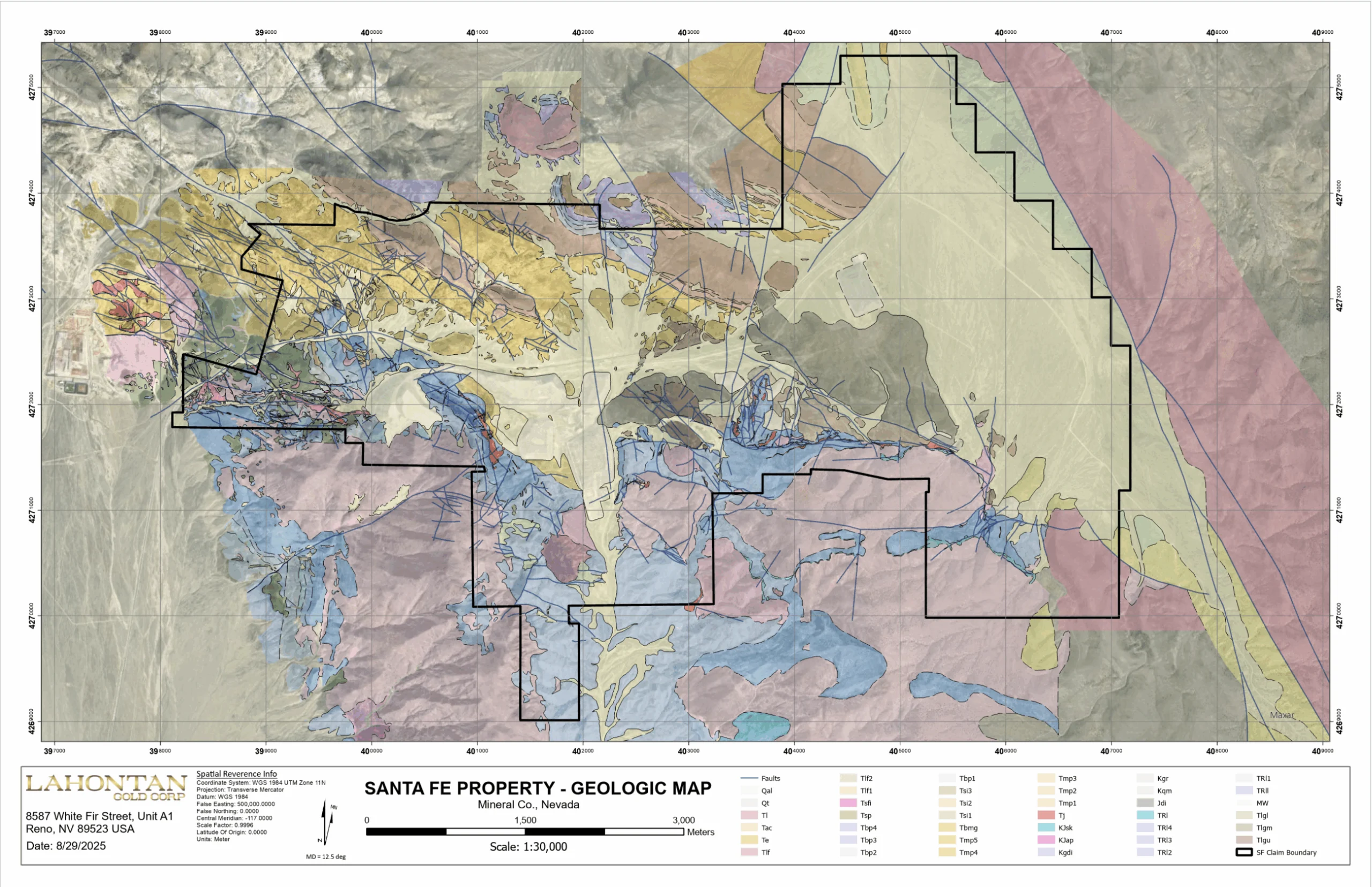
29 August 2025
Property geology
Geologic units and structural setting across the Santa Fe property
View full-size map ↗ (opens in a new tab)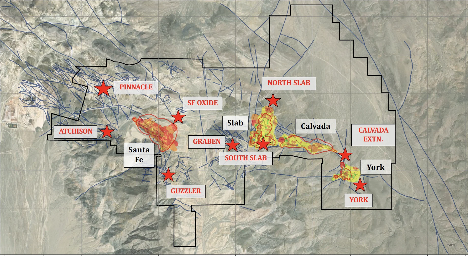
Published exploration reference
Exploration targets
Target areas and their relationship to the historic open pits.
View full-size map ↗ (opens in a new tab)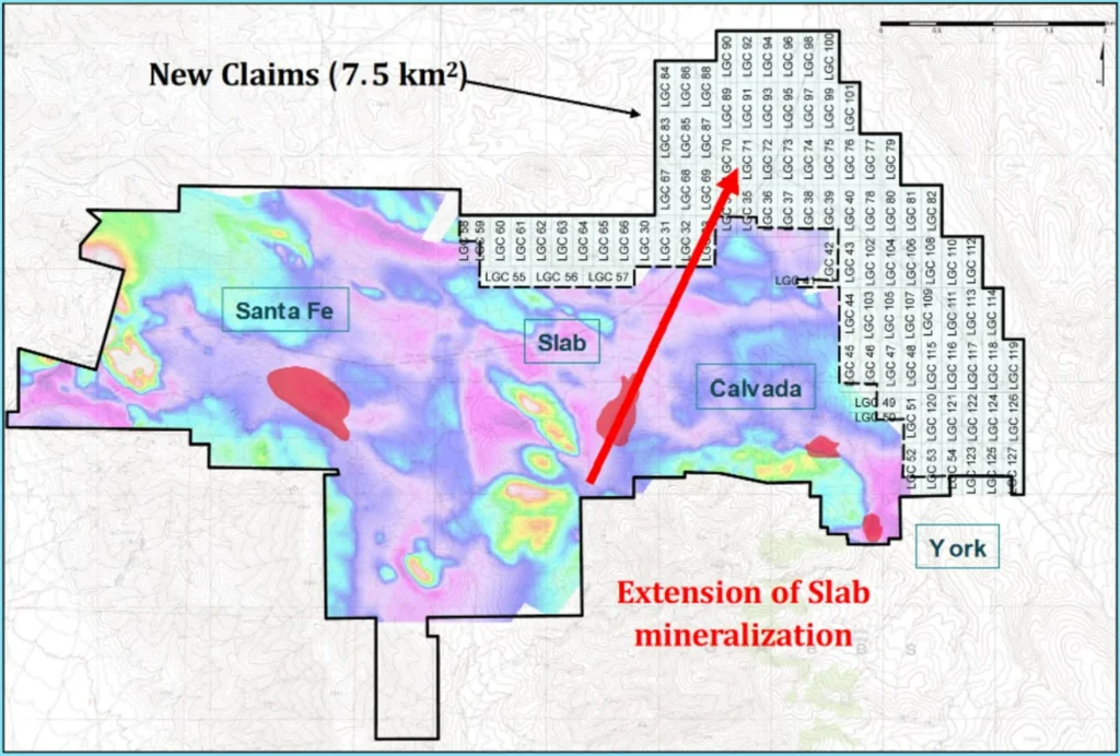
Historical claims reference
Claims expansion
Earlier land-package expansion; not a current ownership or boundary survey.
View full-size map ↗ (opens in a new tab)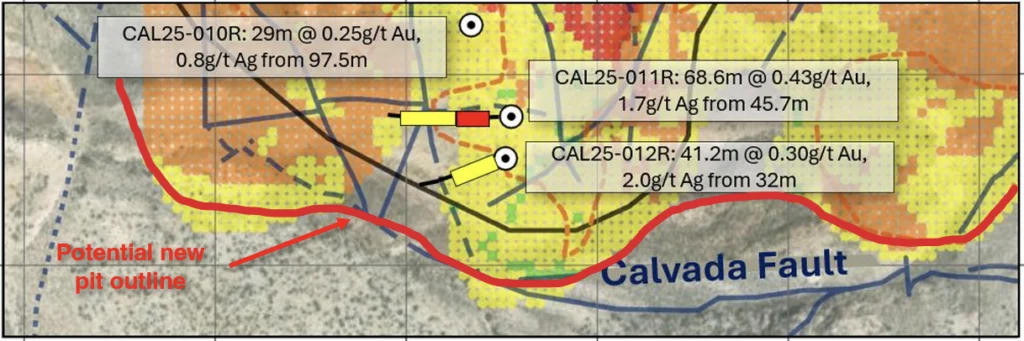
2025 Phase Two drilling
South Slab drill plan
Historical drill locations and conceptual pit outlines, preceding the August 2026 resource update.
View full-size map ↗ (opens in a new tab)These reference maps retain their original labels and interpretations. They do not represent the updated August 2026 Mineral Resource Estimate.
Stay onthe list
News releases, drill results and permitting milestones, sent as they are filed.